CompeGPS AIR 7.3

Open every kind of maps: topographic, vectorial, scanned maps and more
5 
Rating
Your vote:
Latest version:
7.7.2 See all
Developer:
CompeGPS TEAM S.L.
Screenshots
1 / 7
Download

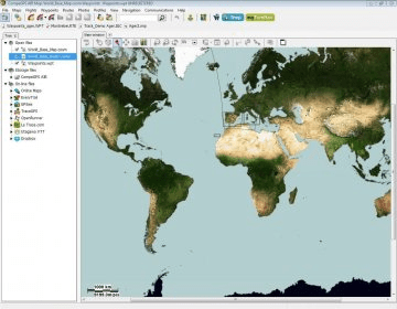
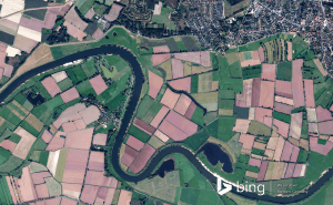
This software application allows you to open every kind of maps: topographic, vectorial, scanned maps or even satellite pictures. Switch to 3D view to start an incredible user experience and get a better appreciation of map elevations.CompeGPS Air is the best way to prepare, analyse and make each of your flight unforgivable.

Comments (1)

5 stars
76
4 stars
0
3 stars
0
2 stars
0
1 stars
0
User

Your vote:

R
Ravinder Singh
Sir, I am Ravinder prop. of universal technology Jammu, J&K, (India) we deal in IT Sector.
Sir, we have an order of Compe GPS Air latest version Qty 02, tell me what is the process for collecting of software.

Was it helpful?  yes(0) no(0) | Reply

Related software

GPSMapEdit
GPSMapEdit
rating

It is designed for visual authoring of GPS-maps in various cartographic formats.

NAVA GPS Office
NAVA GPS Office
Free
rating

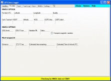
Import, export, visualize your GPS data, set waypoints, edit and create routes.

GPS TrackManager
GPS TrackManager
Free
rating

An application for planning routes & managing routes, waypoints and trackpoints.

ATOM GPS
ATOM GPS
Free
rating

Atom GPS easily geotags your photos directly from your GPS device or track log.

GPS Data Logger
GPS Data Logger
Free
rating

Is a free software for recording, monitoring and plotting GPS data.

Related suggestions